ABOUT
MIDST PROJECT
Project MIDST (Monitoring for Information and Decisions using Space Technology) is an initiative by Kenya Space Agency that seeks to support the National and County Government institutions to address the gaps and challenges highlighted in the assessment report on hardware, software, human resource and spatial data. The aim of the project is to use new and advancing geospatial technologies to co-develop various Earth Observation products and applications, with stakeholders, that could be used by the stakeholders to achieve certain goals within their mandate.

Open Access
To Data/Insights
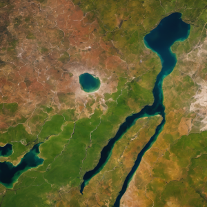
The Kenya Space Agency and its partnering organizations have initiatives to publicly avail datasets in relation the following thematic areas:
- Agriculture
- Climate and Weather
- Natural Resource
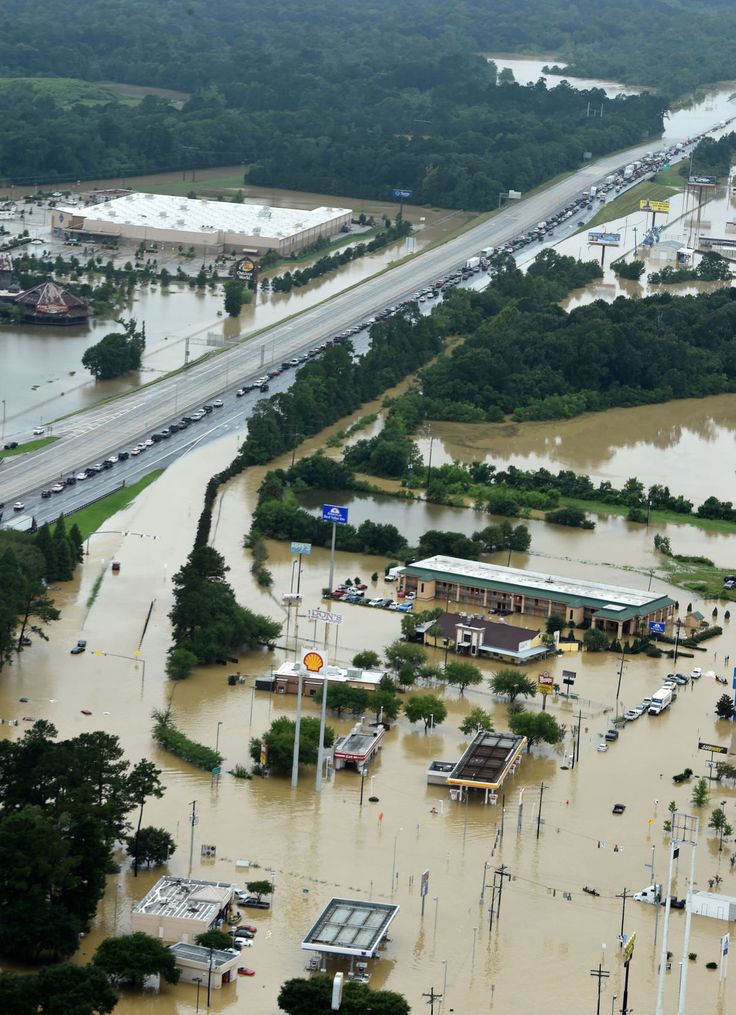
- Spatial Planning and Disaster
Engagement With
Partners and Stakeholders
Project MIDST (Monitoring for Information and Decisions using Space Technology) is an initiative by Kenya Space Agency that seeks to support the National and County Government institutions to address the gaps and challenges highlighted in the assessment report on hardware, software, human resource and spatial data. The aim of the project is to use new and advancing geospatial technologies to co-develop various Earth Observation products and applications, with stakeholders, that could be used by the stakeholders to achieve certain goals within their mandate.
The following institutions have participated in the project in one way or another.
 County of Government
The Council of Governors utilizes space technology, including satellite imagery and remote sensing, to collect and analyze data for informed decisions on various aspects of states' development and governance.
 Department of Remote Sensing and Surveys
DRSRS utilizes space technology, such as satellite imagery and remote sensing, to monitor information crucial for decision-making across sectors like agriculture, forestry, wildlife, land use, and disaster management.
 Kenya Forest Service
Space technology aids KFS in timely monitoring of forest-related changes like deforestation, encroachment, and illegal logging, providing vital data on forest cover, biodiversity, and fire risks.
 Kenya National Bureau of Statistics
bservation products and applications, with stakeholders, that could be used by the stakeholders to achieve certain goals within their mandate.
 Kenya Wildlife Service
KWS uses space technology to monitor information on wildlife crime and collaborate with agencies like the Kenya Space Agency through the MIDST project, addressing development challenges and safeguarding endangered species and habitats.
 Ministry of Defense
MoD, responsible for Kenya's defense and security, benefits from space technology like satellites and remote sensing to monitor information for operational decisions and objectives.
 Nakuru County
Nakuru county government employs space technology, such as satellite imagery and remote sensing, to collect and analyze data for informed decisions on various aspects of development and governance.
 University of Nairobi
The University of Nairobi's Department of Geospatial and Space Technology, collaborating with institutions like the Kenya Space Agency, plays a crucial role in training and research in geospatial engineering and spatial planning using space technology.
 Water
Water
WRA employs space technology, including satellite imagery and remote sensing, to collect and analyze data on water resources, fulfilling its role of monitoring water availability and quality.